top of page
Search

#66: Mental Mapping: A Lesson on Space, Memory, and Perception

Writer's picture: Wen Xin NgWen Xin Ng

Embarked on a mental mapping exercise with my Sec 3 Elective Geography class. This simple yet revealing task allowed us to explore how each of us perceived and remembered our everyday surroundings; how we each experienced space and place in a deeply personal way.


Step 1: Drawing a Mental Map of the School
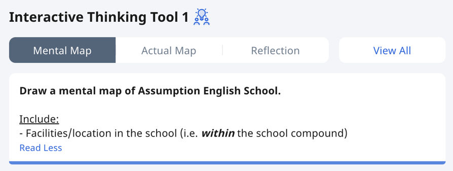
Some submissions:


Step 2: Analysing their Mental Maps

After students completed their mental maps of the school, guiding questions were posed to encourage them to articulate their thought processes.

Reflection:

Class Discussion:

Takeaways:

  1. Identify features (e.g. landmarks, routes) that are common across most maps.

    Discuss why these features are consistently included - what do these commonalities tell us about the shared understanding of the place?

  • We analysed their mental maps together, starting with a simple tally of how often certain landmarks were labeled or drawn.

  • Patterns we saw include how some places—like the canteen, field and spiral staircase—were consistently represented, but others,varied widely.

    • E.g. Only Christine's map included the SC room, since it is a room she frequents as a Student Councillor.

    • E.g. Jovyn's map included the "tunnel", a spot she reports to for softball trainings every CCA day.

    • E.g. Marcus and Ryefan drew each other in their mental maps.

Each map was a unique reflection of the individual’s personal experience within the same shared space.

  • Differences are a result of factors like individual routines, preferences, or places that hold personal significance.

  1. Consider spatial relationships and distortions.

    Compare how different students represent distances and the spatial relationships between landmarks.

  • We discussed why some students perceived some areas as larger or smaller.

    • E.g. The size of the canteen in Sandra, Isaac and Jovyn's maps differed greatly.

These differences/ distortions can reflect each student’s perception of space based on how often they visit certain areas or their feelings about those places.

  • Frequency of Use:

    • Areas that students visit frequently may feel smaller because they are so familiar. Over time, spaces can become mentally compressed as students move through them regularly.

    • Conversely, areas that are less frequently visited might feel larger or more expansive because they are less familiar, leading to uncertainty or a feeling that they are harder to navigate.

  • Emotional or Social Significance:

    • Places associated with strong emotions, whether positive or negative, can distort size perception. . E.g. a crowded or stressful area (like a busy hallway or examination hall) may feel more expansive because of the heightened emotional intensity.

    • Social spaces, where students gather with friends, might be perceived as either larger (because they spend a lot of time there) or smaller (because it's a comfortable, familiar space).

  • Perceived Importance:

    • Spaces that hold significant value might be exaggerated in size in mental maps. E.g. a library or a favorite classroom might appear larger because it’s seen as a focal point of a student’s experience.

    • Alternatively, spaces that feel unimportant or irrelevant to daily routines may be minimised or even omitted from the map.

  1. Compare to a Real Map:

    Compare the mental maps to an official map of the school. This highlights discrepancies between the objective layout and subjective perceptions.

  • We discussed features that were present in students' mental maps but missing from the office map (e.g., personal paths or social gathering spots).

    • E.g. Marcus shared that the space between Block C and the field felt larger than it actually was - for context, this is where he often plays soccer with his friends during break times.

    • E.g. The spiral staircase—a small, winding space students traversed daily but which did not feature prominently on the school's official map—was drawn in most of the students' maps, including Ryefan who drew it literally as a spiral (very mosquito coil-que haha).

  • Official map: 

    • Designed to be an objective, standardised representation of the physical layout.

    • Focuses on accuracy, scale, and the spatial arrangement of buildings, pathways, and areas, aiming to show a "bird’s eye view" of the environment.

  • Students’ mental maps: 

    • Subjective and shaped by personal experiences, routines, and emotional associations.

    • Instead of focusing on technical accuracy, students’ mental maps reflect how they personally interact with the space—what they find important, memorable, or useful.


Step 3: Consolidation

  • Getting students to draw their mental map helped them grasp the importance of mental maps as a way to understand how people experience places differently. By reflecting on what they included, omitted, and emphasised, students gained insight into how subjective factors shape our understanding of space. This encourages critical thinking about how maps are more than objective representations—they're shaped by what each person values, remembers, and experiences.


BONUS:

When I first looked at Jovyn's map, I assumed the stick figures represented her and her classmates. I was both amused and impressed when I realised she was actually depicting the statues in the courtyard (and yes, one of the stick figures was Mother Mary 🤯). It was yet another reminder that mental maps are truly a reflection of one's unique memories and interactions with a space.

For context:


Tags:

10 views0 comments

Recent Posts

See All

Comments


bottom of page